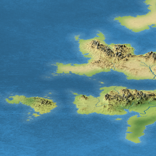
Late last year I opened a new web site, with a new blog. Consequently, I will be archiving the material in this blog, and I won't be posting any new material here. Eventually, all of the posts here will likely be moved over to the new site. Until then, I'll keep this one open.
Please check out the new site here (click the image or the link):
See you there!
Thorfinn
The Cartography of Thorfinn Tait
Mapping fantastic worlds with more accuracy than ever before.
Saturday, 2 January 2016
Tuesday, 6 October 2015
Emirates of Narwan
+Bruce Heard is posting a series of articles on the +World of Calidar's Emirates of Narwan. This arid nation in the southeast of the Great Caldera is one of two former colonies which exclusively worship Soltan, the sun god, forbidding all other faiths within their borders.
If you've read CAL1, you may remember that Meryath's easternmost major island, Kamearea, is also claimed by Narwan. Up until now this is pretty much all we know about Narwan.
The new articles preview material from the upcoming CC1 Beyond the Skies. Although CC1 primarily covers the gods and pantheons of the Great Caldera nations, in so doing it also provides significant back story and other details, making it a real treasure trove of information on the Caldera.
For the second article in the series, I created a 3D view of Narwan upon which Bruce overlaid migration data, resulting in a historical map of Narwan. I wouldn't want to do this with regular maps, because the perspective makes any kind of measurement pretty much impossible, but for thematic maps like this, it seems rather nice. The mountains and hills really stand out when viewed at an angle.
Here are some full resolution views of the map.
Would you like to see more of this kind of thing? Let me know what you think.
Wednesday, 6 May 2015
Moving Beyond the Skies
+Bruce Heard is hard at work on the latest +World of Calidar book: CC1 Beyond the Skies. He has been posting previews of it on his blog for a while now, including most recently excerpts from the main part of the book: the god entries. As you may have guessed from the previews, the main text is well underway, and Bruce is also creating symbols for each god, as well as some pretty amazing plans for major temples.
At the same time, I have begun work on two other aspects of the project: layout and mapping.
The layout is likely going to be very much in line with CAL1 In Stranger Skies, although we're also trying out some new features. One of the big questions is whether to keep CAL1's three columns or switch to a two column layout.
Cartography-wise, CC1 is a very different beast from CAL1. The maps this time will be much more thematic. In addition to Bruce's temple plans, I am working to create some fixed styles for presenting demographic information — which in CC1's case mostly means geographical distribution of faiths. Bruce has already posted maps for each Calderan nation on his blog. Here's a sneak peek at a work-in-progress version of Bruce's Elven Faiths map:
This was a test-of-concept for the area colour-coding, using more subtle borders. I have wanted to try out this technique for many years, but never had a reason to use it until now. It's actually quite a simple matter of blending options in Photoshop, using an inner glow or a gradient stroke. The tricky part is going to be in the colours, and making them fit nicely into the rest of the map. I'm considering embedding some sort of other information into the colours, rather than just having them arbitrary. And I'm also hoping to define a visual style for this type of demographic map that will allow you to see easily at a glance what type of information it's conveying.
More on all of this in the coming months. I'll be back with more news as work progresses. In the meantime, check out Bruce's previews over on his blog.
Here's a handy overview of the extensive material you can get a sneak peek at:
- CC1 Beyond the Skies — project overview
- Genesis of the Briarwoods — timeline preview
- Mythologies
- Dwarven Mythology
- Previews of the Pantheons
- Gods of the Elves
- Gods of the Dwarves
- Gods of Belledor
- Gods of Caldwen
- Gods of Meryath
- Gods of Nordheim
- Gods of Phrydias
- Death and the Netherworld Part I and Part II
Subscribe to:
Posts (Atom)


