Showing posts with label black and white. Show all posts

Thursday, 5 December 2013

Maps of the Day 10-13: Eerien

To the west of the Great Caldera lies the vast continent of Eerien.
Eerien, Calidar, Equirectangular and Lambert Conformal Conic Projections
Eerien, Equirectangular and Lambert Conformal Conic Projections
The top map is an extract from the world map, showing a little more than a quarter of the map, from the Great Caldera in the east to the Isle of Obb in the west, and from Feorad Island in the north, down to Omfall straddling the equator.  From north to south this area is 10,800 km (6,750 miles), and along the equator it's a little over 25,800 km (16,125 miles).  The top line of the map is of course a single point, being the north pole.

Points of interest include a warped view of Feorad Island (compare it with the Lambert Conformal Conic views in the Feorad article to see what a huge difference the projection makes); the positioning of the Great Caldera in regard to the surrounding terrain; the northern part of Omfall, another huge continent which stretches down to the Antarctic Circle; the Aesean Duct, a narrow sea passage bisecting the two great continents; and of course Eerien herself.

Eerien is home to Calidar's tallest mountains, its highest peak reaching a towering 8,925 m (29,281 feet).  As such, the mountain design is of great importance.

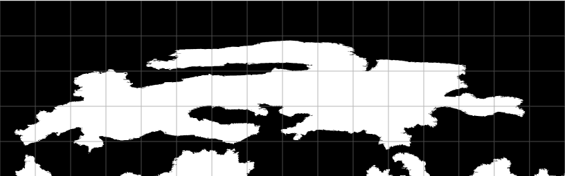
The bottom image shows the true shape of Eerien, projected onto a shape-preserving Lambert Conformal Conic Projection.

The next images show the progression of Eerien's pre-erosion height map design.  This is currently the most developed area outside of the Great Caldera, although other parts of the world are slowly catching up.
Eerien height maps and 3D views, Calidar, Lambert Conformal Conic Projections
Eerien, Lambert Conformal Conic Projection
The top and bottom images are 3D views of Eerien, looking north from a point high above Omfall.  Although they are 3D views, the curvature of the world is not shown, though 3D view of Eerien on the surface of the globe is in the works for a later date.

The top image is a preview of the design, straight from Photoshop.  If you look closely, you should be able to make out that the mountains are all roughly the same height throughout the map - legions of white peaks everywhere.  Eerien is supposed to be extremely mountainous, but we wanted to introduce some variation to the heights.  Considering the sheer size of the base map – a staggering 22,737 × 14,049 pixels – it's not that easy a thing to fix.

However, I came up with an idea, which you can see in the middle image.  It's an adjustment mask which I applied to the base map.  There is a single pure white spot, which remains at full height.  All the rest are increasingly darker shades of grey, which pushed down the height of the mountain peaks under them.  This was all painted manually, and finally blurred before being applied to the height map.

The bottom image shows the result.  At first glance you may be wondering what the big deal is, but look closely and you should be able to see quite a lot of variation has been introduced into the mountain ranges.

One last point: did you notice all the pillars scattered across the bottom image?  These are there for a specific purpose, and of course are only there as temporary markers.  Would you like to hazard a guess as to what they are marking?  Hint: there are lots of them due to the sheer size of the map.

The answer is that they are scale markers, to help keep all the altitudes in sync.  There are lots of them because the map is split up into smaller parts for erosion, and each part must have a marker on it.  The height of the markers is 8,925 m, and on the height map they are pure white, marking the top of the world.

Without these markers, the programs which handle the height maps would make the highest height on each map white, and scale the rest accordingly.  That would mean mountains of 8,925 m all over the world!

he next image shows two renditions of the same height map.  I'm sure you'll agree that the colour version is much easier to read, but unfortunately when I need to make manual changes to the map, I generally have to work on the black and white version.  It's tricky, to say the least.

Eerien, Calidar, height maps, Lambert Conformal Conic Projection
Eerien Eroded Height Map, Lambert Conformal Conic Projection
This is the second draft of Eerien.  In order to perform erosion on this massive continent, I had to split it up into six different sections, each up to 9,999 x 9,999 pixels.  Of course the sections had to overlap, or putting them together would have been very difficult, since rivers would run in completely different courses.

Eerien's erosion has resulted in some very interesting terrain.  My favourite part is the plateau, which has gained a Grand Canyon-like ravine.  Immediately north of the plateau are the highest mountains in the world, so it's a fascinating area all round.
Eerien, Calidar, 3D views of eroded terrain, Lambert Conformal Conic Projection
3D Views of Eerien, Lambert Conformal Conic Projection
In this last image, we present five different 3D views of Eerien's terrain.


At the top you can see the continent in its entirety.


The middle row shows two different perspectives on Calidar's version of the Himalaya Mountains and the Tibetan Plateau.  These are the highest mountains in the world, although it may be difficult to see that at these distances.

The plateau itself is not entirely flat, with its most predominant feature being the massive ravine which snakes its way through.  Presumably all the runoff from the mountains to the north has carved this huge scar into the plateau over many aeons.

Finally there is a closer look at the lowlands to the north of the great mountains, and then a look at the imposing mountains themselves from nearby.

That's it for Eerien for now.  As the Kickstarter start date approaches, we will continue to reveal the World of Calidar.


Wednesday, 4 December 2013

Map of the Day 15: Omfall

Calidar's western hemisphere is home to two great continents.  Last week we explored Eerien.  Today our world tour brings us to Omfall.

Stretching from 22ºN all the way down to 67ºS, Omfall is a massive continent encompassing a large variety of terrain types.  Omfall pushes right up against Eerien to the north, with but a narrow channel running between them.  This channel is known as the Aesean Duct.  The tropical Mareas Island is in the northeast of this map, between separating Omfall from the Great Caldera.  Below that is the Taslan Peninsula.  From both Mareas and Taslan run strings of islands which connect up with the Arm of Ule, separating the Calderan Sea from the great Penggelan Ocean along Omfall's eastern coast.

Omfall, Calidar, Stereographic Projection

In the far south, the Cape of the Last Howls points south towards Mormoroth, touching the Antarctic Circle.

I am currently working to finalise Omfall's height map for the erosion process.  In Omfall's case, because it's so huge, erosion will likely take about a week.  It's important to get the terrain right before starting erosion, because fixing problems is much harder after erosion.  If we need to revise the map, it generally means going back to the pre-erosion map, then running it through erosion once again, which takes up a lot of time.

Omfall mountain design, Calidar, Stereographic Projection
Omfall Mountain Design
Stereographic Projection
As with previous maps, Omfall's height map was built from +Bruce's mountain design.  The thick brown lines represent major mountain ranges, while the thinner red lines are more minor ranges.


Take a look at how the design evolves.  The first draft quite faithfully follows the mountain design.

Omfall uneroded height map, Calidar, Stereographic Projection
First Draft
The mountain ranges are too regular, don't you think?  They needed messing up a bit.  This was done in the second draft.

Omfall uneroded height map, Calidar, Stereographic Projection
Second Draft
You can also see some notes from Bruce marked up in the second draft.  These were areas to lower.  The third draft incorporates these changes.

Omfall uneroded height map, Calidar, Stereographic Projection
Third Draft
The fourth draft, which I am working on now, includes the all-important altitude scaling of the mountains which I mentioned previously for Eerien.  Without this scaling, all of the mountains throughout the continent will end up being roughly the same height.

There are two more islands to look at to round out the western hemisphere.  Come back again tomorrow for a look at the first of these.

Monday, 2 December 2013

Map of the Day 14: Mormoroth

Welcome to the third week of daily Calidar maps.  This week we continue our world tour, with a new continent each day – beginning with the south polar continent of Mormoroth.
Mormoroth: Calidar's South Pole, 3D View of Eroded Height Map, Polar Stereographic Projection
Mormoroth, 3D view of Eroded Height Map, Polar Stereographic Projection

Mormoroth: Calidar's South Pole (First Draft), Polar Stereographic Projection
First Draft, Polar Stereographic


Mormoroth: Calidar's South Pole (Second Draft), Polar Stereographic Projection
Second Draft, Polar Stereographic
As I have mentioned in previous posts, the polar areas can be the most problematic for any world builder.  This is because it is easy to draw onto a rectangular world map – which of course warps the poles more and more until the top and bottom lines of the map represent the points of the poles.
Mormoroth: Calidar's South Pole (First Draft), Equirectangular Projection
First Draft, Equirectangular
Mormoroth: Calidar's South Pole (Second Draft), Equirectangular Projection
Second Draft, Equirectangular

Calidar was no different, and the polar regions caused so much trouble that at one point we considered simply having no land in these regions of the map at all.  However, in the end we used map projections to solve the problem.  The result is the design you see on the left.

The small strip below each Polar Stereographic map is the bottom strip of the Equirectangular world map, from 90ºS to 60ºS.  In other words each of the above pairs of images displays the same area.  Note how the first draft coastline design looks smooth on the Equirectangular map, and yet hideously spiked on the Polar Stereographic map.

What I did was to redraw the coastline on the Polar Stereographic map, resulting in the second draft image on the right.  Then I reprojected the new design back to Equirectangular, and slotted it in to the world map – as you will see perhaps next week.
Mormoroth: Calidar's South Pole, Mountain Design
Mountain Design
Polar Stereographic Projection
(Cropped for erosion)

With the projection issues sorted, I'm sure you all know by now what came next: mountain designs, followed by erosion.  After Bruce gave me the okay on the new coastlines, I had to adapt the mountain design to it, then work on the height map.

The funny thing about Mormoroth is that since it lies at the south pole, most of the height map design will not be visible on any map – it will all be buried in a massive ice sheet, with only the highest mountains sticking out the top.

Undaunted by this, I went ahead and developed the area anyway.  I have yet to work out how to implement the ice sheet itself...  In the meantime, here are some views of the eroded height map – a peek beneath the ice sheet, if you like.

Mormoroth: Calidar's South Pole, Eroded Height Map

Mormoroth: Calidar's South Pole, 3D View of Eroded Height Map

Mormoroth: Calidar's South Pole, 3D View of Eroded Height Map

Join me again tomorrow as we journey north again to one of Calidar's undiscovered continents.

Saturday, 30 November 2013

Map of the Day 9: Feorad Isle

Welcome to week two of Map of the Day–the Calidar World Tour!
Feorad Isle, Calidar's northernmost land, Lambert Conformal Conic Projection
Feorad Isle – Calidar's northernmost land, Lambert Conformal Conic Projection

Feorad Isle, Calidar's northernmost land, Equirectangular Projection
Feorad Isle, First Draft
Equirectangular Projection
Feorad Isle, Calidar's northernmost land, Lambert Conformal Conic Projection
Feorad Isle, First Draft
Lambert Conformal Conic Projection
We begin our world tour this week with a look at the top of the world–the north pole.  There is no land at the pole itself, but there's an island close to it, which is known as Feorad Isle.  It's likely a cold, mostly frozen land, the vast majority of which lies firmly within the Arctic Circle – which on Calidar lies at 66.5ºN.

Continuing last week's discussion of projection problems, the north and south polar areas of any world pose a particularly thorny problem for world builders working with a rectangular base map, such as the Equirectangular Projection.  The problem is that areas north of 60ºN and south of 60ºS are stretched progressively more and more, until the single point of a pole is represented by the whole top or bottom edge of the map.

Feorad Isle, Calidar's northernmost land, Lambert Conformal Conic Projection
Feorad Isle, Second Draft
Lambert Conformal Conic Projection
Draw landforms in the normal way, and they will invariably end up spiky and squashed-looking.  You can see this in the first draft images on the left.  The solution is to reproject the map to a more suitable projection, and design the area using that projection.  Later, this can be projected back to Equirectangular and added back in to the base map – where of course it will now look stretched, but that's as it should be on that projection.

Feorad Isle, Calidar's northernmost land, Equirectangular Projection
Feorad Isle, Second Draft
Equirectangular Projection
The second draft black and white images show the fixed coastlines, first edited on a Lambert Conformal Conic Projection, then reprojected back to the base Equirectangular Projection.

It's important to consider projections when designing terrain, too, because otherwise the terrain will end up just as warped as the coastlines here were.  This is why each of Calidar's continents has been designed using a projection chosen for that continent.  The Great Caldera is circular, and away from the equator, so it uses the Stereographic Projection.  Feorad Isle is close to the north pole, and so could use Polar Stereographic, but the other side of the pole is uninteresting, with no land, so instead I chose the Lambert Conformal Conic, whose shape is very efficient in this case.


Feorad Isle, Calidar's northernmost land, mountain design, Lambert Conformal Conic Projection
Mountain Design
Lambert Conformal Conic Projection
Looking at these images again, I wonder if perhaps I have gone a little too far in reducing the spikiness of the terrain.  What do you think?  Please let me know in the comments.

After the coastlines have been fixed, it's time to build a height map, working from +Bruce Heard's mountain design.  In this case, the design was squished by the projection change, so it required quite a bit of tweaking; working in an appropriate projection is important not just for coastlines, but also for terrain design.  Even a long mountain range painted onto the Equirectangular projection maps above will be squashed down to a much shorter one when reprojected into Lambert Conformal Conic – or onto a globe.


Feorad Isle, Calidar, satellite view, pre-erosion terrain design, Lambert Conformal Conic Projection
Pre-erosion terrain design–satellite
Feorad Isle, Calidar 3D view, pre-erosion terrain design, Lambert Conformal Conic Projection
Pre-erosion terrain design–3D view


Once the base height map has been designed, it's time for simulated erosion.  In the 3D views here you can see the map in its initial design stage, then in its finished stage.  Note the very distinctive valleys carved into the land, and also how the blobby orange hills turn into sculpted peaks.


Feorad Isle, Calidar, satellite view, post-erosion terrain design, Lambert Conformal Conic Projection
Post-erosion terrain design–satellite
Feorad Isle, Calidar 3D view, post-erosion terrain design, Lambert Conformal Conic Projection
Post-erosion terrain design–3D view


As with the black and white coastline maps, the finished height maps are reprojected into Equirectangular form and added to the world map.  In this way, the world map is slowly taking form. Once its complete, we'll be able to produce accurate maps of any section of the world in whatever projection is needed.


Next time on our world tour, we will journey southwards to one of Calidar's biggest continents of all.

Thursday, 28 November 2013

Maps of the Day 1-3: Mapping the Great Caldera

Welcome to the Calidar Map of the Day series!  In this series of posts, I will be sharing a pre-production or work-in-progress map every day to preview my work on +Bruce Heard's upcoming setting, the +World of Calidar, which I am involved in as cartographer.


Great Caldera, Calidar, Equirectangular Projection
The Great Caldera, Equirectangular Projection
Our journey through Calidar begins with the Great Caldera – the heart of the setting, and the most settled region on the planet.

The result of a massive collision in Calidar's ancient history, the Great Caldera is a perfect circle with a mountainous rim.  This presents a unique mapping challenge: drawing a circle on a sphere is easy, but the rectangular map projections usually used to design worlds are another matter entirely.

The 2:1 latitude/longitude grid known as Equirectangular, Plate Carrée, or simply Geographic Projection is very useful because it is easily applied to 3D spherical models, such as Google Earth.  But the further north or south you go, the more stretched it becomes, until the entire top and bottom lines of the map represent the single points of the poles.

The Great Caldera stretches from 25º to 65ºN, putting the northern part of the Caldera in an area which is very susceptible to these distortions.

Look closely at the first map.  Does it look like a perfect circle to you?  Probably not.  But in fact it is a perfect circle when viewed on a globe.


Great Caldera, Calidar, Stereographic Projection
The Great Caldera, Stereographic Projection
This companion map shows the exact same coastal outlines as the first map, but using a more suitable projection for a circular area.

The Stereographic Projection is particularly appropriate for the Great Caldera, because it shows any circle on the globe as a circle on the map.

If we had just drawn a circle on the Equirectangular Projection base map, it would have ended up being deformed when viewed on a globe.  These days, when it's very easy to set up Google Earth or a number of other programs to display interactive globes in the computer, it was a design priority to get these projection issues right from the start.

Getting back to the map, you can see how the perfect circle of the Great Caldera has collapsed and decayed at various points.  We'll take a look at the design phase for the mountains encircling the Caldera in the next post.


Great Caldera, Calidar, wrong version, Equirectangular and Stereographic Projections
The Great Caldera (Uncorrected Version), Equirectangular and Stereographic Projections
The first two maps showed the final, corrected version of the Great Caldera.  It only looks circular in the Stereographic Projection, of course, but place the Equirectangular Projection on Google Earth and it will become circular again.

This last map predates the first two, showing the same design for the Great Caldera, this time as a political map showing borders and country names.  The inset shows Bruce's original design, which we did on an Equirectangular Projection (as many mappers do, since it allows the aforementioned use of Google Earth).  It looks fine – a perfect circle.  The problem with this is that when it is applied to a globe or other 3D spherical model, the Caldera's shape is deformed, appearing more like it looks in the Stereographic Projection.

So the first two maps above are the result of a proper implementation of this design, as Bruce originally intended it to look.  One last map to illustrate my point: this rendering of the globe of Calidar was made using an Equirectangular Projection world map.  Note how the Great Caldera looks nice and circular, as it is supposed to.
Calidar, Great Caldera, Mareas, Ule, Taslan, Eerien, Laëril, Equirectangular Projection, render of globe
The World of Calidar, Orthographic Projection (also known as "View from Space")
We will continue to look at the effect map projections have on the shapes of Calidar's landforms over the next few weeks.  But before that, let's delve a little deeper into the terrain design, starting with the mountains, and then moving on to height maps.